
After a night in Yreka (and breakfast at Grandma's House) we popped over the
mountains
and down into the Scott Valley on Hwy 3. In the distance are the Trinity Alps.

For future reference we checked out the town of Callahan, just before turning
off on the road
toward Cecilville. Would they have had a motel, if we'd made it this far?
Not anymore...

It's a big climb up over a mountain to the South Fork trailhead near Cecilville.
With our radiator troubles we stopped now and then in the shade to let the
car rest.
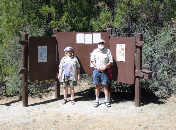
Ellen and Scott at the trailhead.

For the first six miles or so we followed the Little South Fork Trail.

Crossing the Little South Fork. Right after this the trail climbs steeply
up a
set of switchbacks with ten (yes, ten) legs. Then a long level walk. Then
another
set of switchbacks. Then another long walk...

And finally we reached the first level ground in six miles, the camp at the
upper
Little South Fork crossing. From here the trail will leave us as it goes on
toward
Caribou Lakes, and we'll be following the Little South Fork on up toward the
lake.
This campsite is well-furnished with log rounds at convenient heights, and
mice!

There was a bit of a path, up above the Little South Fork. About a quarter-mile
above
the camp there's an easy approach to the water, and we took a short break
to leave a cache of peanuts and granola dangling from a tree over the river.

We had an easy day, reaching our second camp in the early afternoon.
After hanging our food to keep it safe from bears or smaller visitors, we
set out unencumbered by packs to scope out the next morning's route.

Following a dry streambed we get our first glimpse of the falls on the right
fork.

Close up of the lower falls.

We found our way, alright, a staircase. Oh my gosh, I have to do this tomorrow
with a pack???

Back at camp, we set up our little tent.
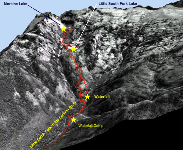
This 3D rendering of an aerial photo shows the track we will take up and down
from
the waterfall camp in the delta near the bottom of the picture.
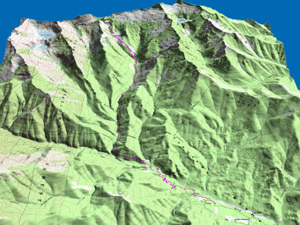
Using the same trick of laying something over the DEM (Digital Elevation Model),
here
Scott has created a 3D version of the USGS map, showing our track for the
whole trek.
Note that on this map you can see the lakes in nearby valleys, Caribou Lakes
to the east
(you are looking south, so that's to the left) and Grizzly Lake to the west.

The next morning we set out again, this time fully loaded.

Scott climbing "The Staircase" with his pack.

Above the lower waterfall is this steeply sloping rock.
It's just possible to keep your footing!
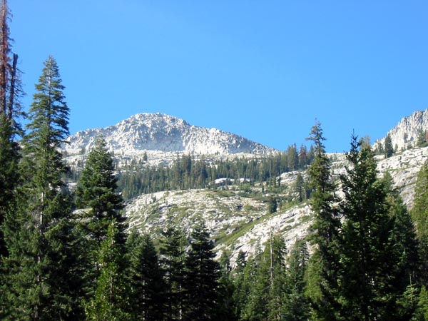
From the top of the falls we could see the granite peaks up above.

Here are the upper falls. It seems our way will go alongside the right fork
at first.

Yes, this IS the way... Scott was leading. "Hey, how'd you
get through this," I called. Just step on the branches, he says.

Yes, we did come up this rock face.

After a grueling ascent we are rewarded with this view of a little tarn. Little
South Fork Lake
is just visible in the background.

Reaching Little South Fork Lake, we made camp on a small peninsula,
and then set out to explore the eastern end of the lake.

High granite peaks are above Little South Fork Lake.
We tricked the camera into seeing what was in deep shadow.

From the east end of the lake Scott points toward a peninsula exactly opposite
our camp.

We loved this SMILING intrusion in a big granite boulder. Nice lips!

This is the outlet of the lake, near our camp, the morning of the second day.
This has to be one of the easiest stream crossings ever.

The waning gibbous moon is just about to go behind the ridge.

We go get our counterbalanced bear bags down for breakfast.

Then we set out to see if we can reach Moraine Lake, higher on the mountain.
Our way takes us across a large granite rockfall, and we leave cairns
so we can find our way home.

The rockfall gives way to a lovely meadow filled with wildflowers.

We move over to climb up the streambed itself.
Note the little waterfall in the background.

Here is Moraine Lake, still with its snowfield at the beginning of September.

We are blown away by the aquamarine color of the water.

Ellen is tempted to dive in from this well-placed cube of granite.

BRRRRRRRR!!!!

Scott pumps water.

We climb above the lake through this charming meadow in a slot.

We get to a rocky ridge.

From up here we have a perfect postcard view of Little South Fork Lake.

That night it is so still that when we wake in the morning there is not one
ripple on the lake.

Time to head down.

This time, trying to avoid the underbrush route, we find a steep path through
the woods.

Back at the top of the waterfall.
Hurray for vibram boot soles.

And now, down "The Staircase."

After another night at the waterfall camp, we set out down the trail again.
Scott checks the GPS reading where the trail cuts through some old mine tailings.

It's a long way down, but pleasant going.
We see fresh tracks on the trail here, including horseshoe prints going up.
But we haven't seen a soul for six whole days.

Just moments after we emerge into the parking lot,
a family on horseback comes out behind us.