On Saturday, June 2, we set out for the first attempt at our 2012 Emigrant Wilderness Adventure. We got as far as Strawberry, California, over the Sonora Pass on Hwy 108 and down the other side. Scott's mother had been hospitalized, and we turned around after a short rest at the Strawberry Inn, heading back to Reno in the pre-dawn.
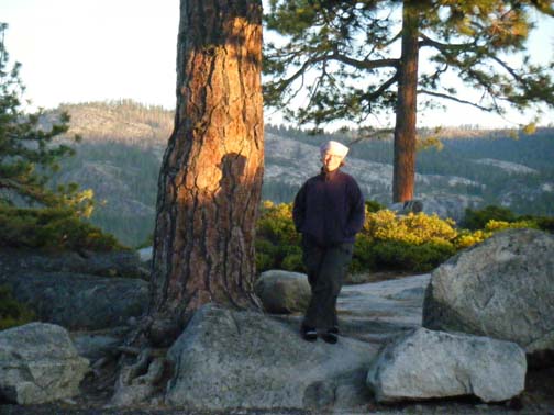
«The Sierra was very beautiful, and we took a short walk at the Donnell Vista to watch the sun rise and view the Dardanelle's across the Stanislaus River canyon.
Sadly, Scott's mother wasn't able to recover from the electrolyte imbalance that put her in the ICU, but we were blessed to have family with her in her last week, and she died peacefully on the morning of Sunday, June 17. You can read more about the amazing Elaine Parker here.
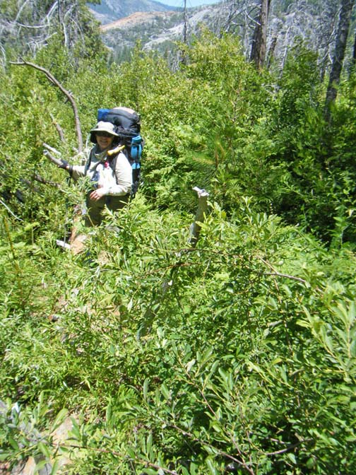
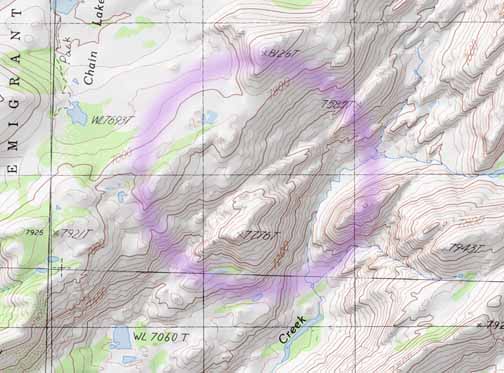
On Monday, July 2, we set out for our second attempt. Tuesday afternoon found us headed in toward the Cherry Creek canyon from a parking spot below Shingle Springs, on the east side of Cherry Lake. There isn't exactly a trail here, and we spent several hours thrashing through brush. Ellen lost both the borrowed GPS radio and her temper during a hellacious bushwhack about which the less said the better. Scott worried that we wouldn't find water or a spot large enough to camp, but eventually we reached both.
The next day, after we'd made good time on the open granite, and just as we were getting to the crux of the gateway into the canyon, Ellen hurt her arm hoisting her pack off a rock. We decided to head back out and seek medical attention.
«Here's Ellen, left arm in a bandanna sling, on the way out. Behind her, you can see some bare red rock in the distance. That's how far we got before we had to turn around.
We did get out, and drove a couple of hours to Sonora, and straight to the ER. We looked pretty rough. Some of the way out had been through burned sections of forest, and we were somewhat sooty. The young doc who examined Ellen turned out to be a backpacker, too. He carefully felt her arm and said, “Oh, good, the tendon heads are intact.” He explained how muscle can tear, and advised two weeks of rest. Scott said, “Can she hike?” Dr. Klatt looked at him in silence, and Scott said, “Well, we’re down here until the 11th. Could we go back in? If we stayed on trails?” Dr. Klatt said he guessed that wouldn’t be hard on Ellen's arm, if she didn’t use a pole on that side, and as long as she was comfortable. He agreed it would be best to go on a trail. He advised Ellen not to immobilize her arm, although he thought it might be most comfortable in the sling while hiking.
He knew all the trails, and advised us about a particularly good one from the Bourland Creek trailhead, a ways west of the one we had started at on July 3rd. Although the trail was not on the maps, he attested to its being continuous, well-maintained, and suitable to our purpose.
.jpg)
«So the next day (Friday, July 6) we drove back along Hwy 31, and headed into the wilderness from the Bourland Creek trailhead. Here we are, about to set out.
This was truly a beautiful trail, following a disused road gently up a hill through a lovely pine forest. And it was a gorgeous day, warm and sunny. We were starting much higher than we had been at Cherry Lake. There were mats of alpine lupine and pussy toes. The going was easy, so Ellen got along fine with only one pole. Our hearts were light, knowing we'd get some time in the wilderness after all.
As we approached the ridge, the forest thinned, and the landscape was dotted with large boulders. From the ridge there was a bit of a view to the east down into the West Fork Cherry Creek Canyon, which was our new destination.
The trail, however, was not so obvious here. Later we would learn that it continued north along the ridge, but was obscured by a large fallen snag.
In the absence of better information, and guided by some misleading cairns, we headed off down the other side of the ridge.
Once again we found ourselves in brush, and on a steepish hill to boot. But there was no going back. On a Sierra hillside the brush, crushed all winter by snow, has a distinctly one-way character. It’s like those metal spikes at the rental return lot, where you can easily drive over one direction but not the reverse.
We continued our descent along the ridge of a prominent finger of granite that prods West Fork Cherry Creek into an eastern bend, hoping this would furnish us with a gentle route to the canyon floor.
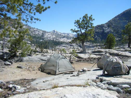
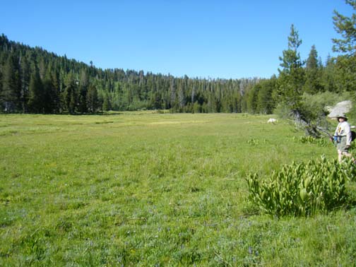
At a saddle halfway down, we found a sweet little meadow just big enough for a tent, and, since it was nearly dusk and we had enough water for one night, we decide to make camp here. When it was dark, we could see the lights of another camp to the northeast of us, upstream.
«Here's our camp in broad daylight, looking upstream. The photo doesn't do justice to the fact that the trees in the background are far, far below us!
Scott was able to climb down to the West Fork, and he rigged a way to carry water back to our site in our new Katadyn drip filter bag. With water handy, we decided to make this our base camp. We did day hikes from here the next two days, first downstream and then upstream.
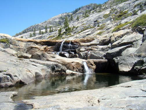
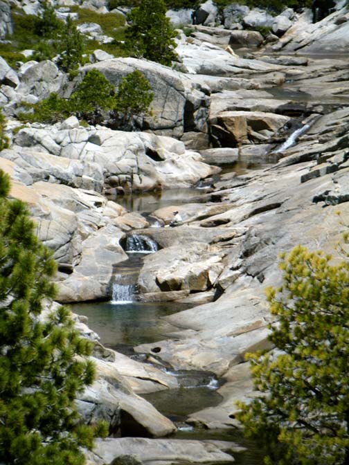
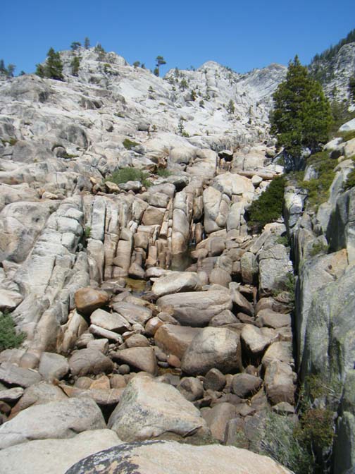
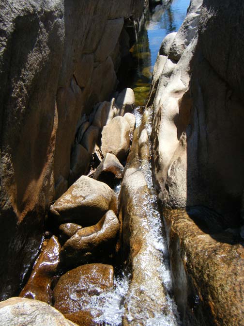
The going was tough in the downstream direction, but the waterfalls and cascades were lovely.
«Here's Scott on a ledge between two waterfalls.
The next day we headed upstream. We met the guys whose campfire we had seen. They gave us a lot of helpful information about the trail we had lost coming in. They pointed out a landmark on the ridge above: a craggy point that the trail had to circumvent on the south side.
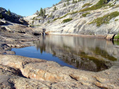
Past their camp, we headed up along a series of ponds on the creek. The brush and forest made for tough going through this area.
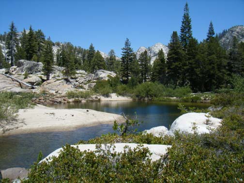
«That's a sandy beach across this pond from us.
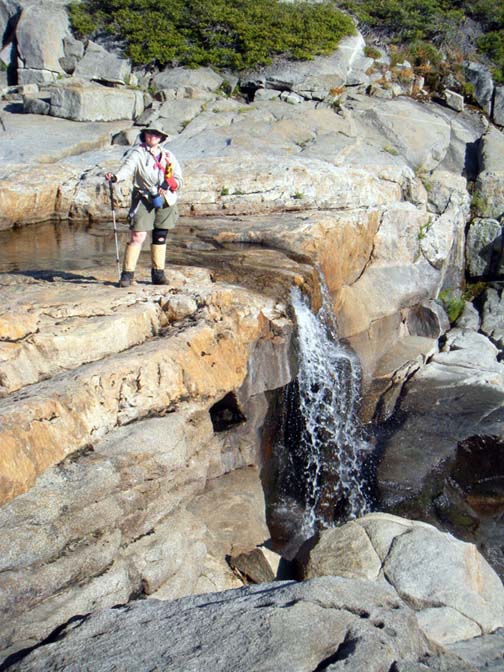
We were able to get almost all the way to the point where the West Fork pours out from between two large roches moutonee (granite features smoothed by glaciers, steep on the front side and gentler on the back).
We would love to return here to close the gap between this spot and the point where Piute Creek joins the West Fork on the other side of this pinch point. We call this the Area of Mystery, and it's our ambition to explore it!
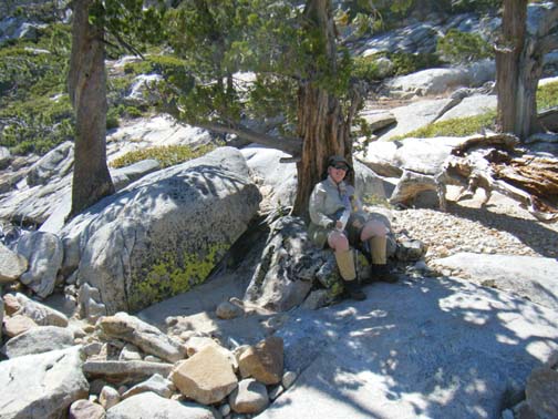
«Here's Ellen resting at the point where we turned around. It was time to head back — we had a long way to go, and the day was getting late.
But our adventures were not over yet! As we hopped from boulder to boulder in the stream bed, Scott suddenly stopped. "Hold up," he said. "There's a rattlesnake!"
«Sure enough, there was, and it was all coiled and ready to strike, too - though not actually rattling. Luckily, it was content to mind its own business, and we didn't get too close. We didn't really want to field test our kevlar gaiters.
We sure didn't hop quite so quickly from one rock to the next from there on.
The next day we packed up camp and moved uphill to Point 7147. With the information we'd gleaned about the trail we thought we might be able to find it from that point, and, following a compass heading from our camp toward the craggy point the other campers had noted. And we were successful! It was less than a half a mile of relatively easy going through the forest to a well-worn and very distinct use trail.
We followed the trail back down through the forest into the West Fork canyon, to the point where it emerged onto granite. Then we turned around and followed it back all the way to the point where we'd first lost it. We saw the fallen snag that obscured the trail. The other campers had marked the right way with cairns, and we enhanced the marking of the right way and decapitated the misleading cairn that suggested the wrong way.
«On our way back, we took a detour from the trail down to Bourland Meadow,
We were looking for any sign of an old pack trail that Scott had a track for on the map. The only evidence we found was a section of the use trail where there were old blazes on the trees. Away from the use trail, we could find no sign of the old pack trail.
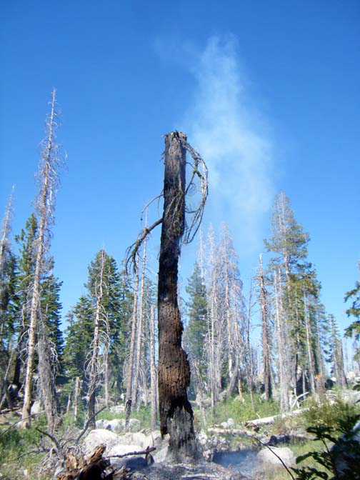
The next day we hiked out on the trail, and it was such a walk in the park that we were back to the car quite early in the day. We decided we had time for a day hike from the Box Spring Trailhead, just to check it out.
«About 20 minutes down the trail, Ellen spotted smoke. A standing snag was on fire!
Using the satellite phone we were carrying for emergencies, we called it in to the Groveland Ranger Station, and they said they would send someone to check it out.
Scott worked at creating a safe buffer around the burning area and stamping out the bits of grass that were burning.
After about an hour of monitoring, we decided the fire wasn't going to spread and trap us on the trail if we went on, so we hiked in until we got to a place we'd been before, in June 2010, just below the Chain Lakes.
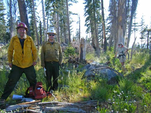
«On our way back, we met the two wildland firefighters who had responded to our call. They told us the fire was almost certainly human-caused, and since it was just outside the wilderness boundary, they would contain it.
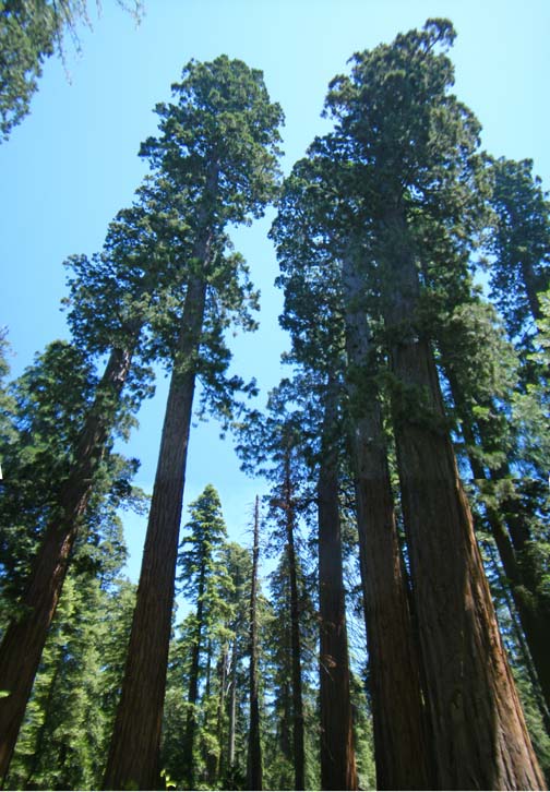
That night we stayed at the Long Barn Lodge. We decided to head back to Reno via Hwy 4, for variety, and stopped at Big Trees State Park along the way. In the park there are two large concentrations of Sequoias, at the northernmost end of the range.
«Here is a stand of sequoias in the North grove, which has a guided walk on a paved trail.
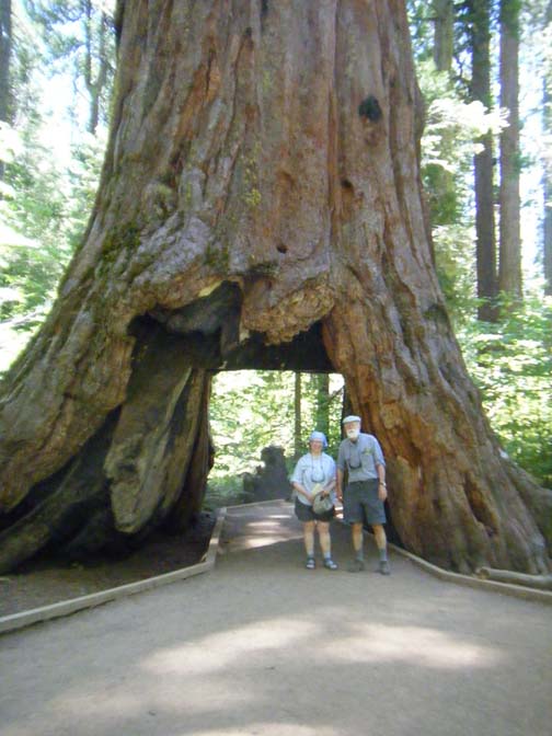
«And here we are in the "Cabin Tree." This passage was carved out so that Big Trees could compete with the famous tree people could drive through in Yosemite. But the carving out of the passage wasn't good for the tree, which is barely hanging on at this point.
By the way, if you are ever thinking of driving Hwy 4 from Sonora to Nevada, think again. Once past the Bear Valley Ski Area this state highway becomes a one lane road that winds and twists as though built before dynamite, over not one but two mountain passes. We think Hwy 108 is windy and twisty, but at least each direction has their own lane the whole way!